This was the trip I had wanted to make for a few years, the hike that I knew would be the best one yet, the one trip that always needed more time than I had to spare. And having made the trip I can assert that it is true, you haven't really seen mountains until you are in the Himalayas. In my opinion, this is because it is extremely difficult to obtain any sense of height or space in these mountains. There is no "top of the world" view, and that is humbling and oddly exhilarating. If Kerala and Kumbakonam (Part I and Part II of my blog) merit being known as God's own lands, Uttarakhand is equally deserving of the title. There is a divine quality to nature here.
I quit my job this May, and decided to take a two month break before I started my next academic adventure. I emailed my friend a one liner the same day, "Do you want to trek the Himalayas this summer?" She called me back and said "Lets do this!", and the planning began.
We did not want to take part in any tourist packages for they always seemed to include places which were not on our agenda, and hence took longer than we had time, and demanded more money than we cared to spend. I have been on quite a few hiking trips in the US, but they have always been very easy to plan because of the multitude of information on websites, online booking for hotels, car rentals, etc. Planning this trip was like locating a book in an uncatalogued library. All the information and tips the two of us finally zeroed in on was consistent information we found on other travel blogs without which we could not have made this trip. I hope my blog is just as useful to anyone else who wishes to make a trip to the Valley of Flowers National Park.
Valley of Flowers is only open during the months of July through September which also coincides with the monsoons and the season of landslides. The valley really begins to bloom only after mid July, and the first half of August is perhaps the best time to visit it.
Day 1: Delhi to Haridwar: We left on an afternoon train from Hazrat Nizammudin and reached Haridwar around 8 PM. It takes 6-7 hours, and one may also take buses, and taxis to get to Haridwar. But, we had decided that this being the first stage of our journey, and the only predicatable part of it, we would rather get through this without any hiccups and opted to travel by train. We had also made a reservation at Garwal Mandal Vikas Nigam (GMVN) hotel for that night. The hotel is a 3 minute walk from the Haridwar railway station. The buses to Joshimath also depart from across the road at GMVN. We paid Rs.600 for the room, and were quite satisfied with it.
I recommend reserving bus tickets as soon as arriving in Haridwar. It is also a good idea to book tickets on the first bus out of Haridwar, which is typically at 4:00 AM. The last bus is scheduled to depart at 7 AM, and there are usually 3/4 buses that run that route everyday. While the final destination of this bus is Badrinath, you need to get off at Govindghat. The summer months being the peak pilgrimage season, it is likely that you may not find tickets on this bus. We managed to get tickets to Joshimath on a bus that was scheduled to leave at 6 AM. We paid Rs.400, but I suspect 300 or 350 would have been the right fare.We made no advance reservations for any part of our journey henceforth because we were open to the possibility that we may not be able to obtain bus tickets for that morning, and that we may get delayed by more than a day on the road in the event of landslides or poor driving conditions. We had heard of people who were stuck on the road for up to 4 days. Also, make sure you withdraw plenty of cash at Haridwar.
Day 2: Haridwar to Joshimath : As common with public buses, we did not leave at 6 AM. It was in fact closer to 8 AM by the time the driver had decided that he had enough passengers to warrant the long journey. We bought a couple of ponchos at the bus stop, which turned out to be a great idea, as these get far more expensive the farther into the mountains you go. It takes 10-12 hours to get to Joshimath depending on the condition of the road (there is only one road), and the number of stops the driver makes. The bus journey of a lifetime began by the time we were driving through Rishikesh.
The only other time I had seen Ganga was in Bengal where she was mellow and murky, and yet somehow beautiful before flowing into the sea. Here was Ganga from the books of yore. She was a tonic to the eyes, music to the years, and her gay laughter made you smile. NH 58 is a narrow road that connects Haridwar to Badrinath with steep, and rocky hills on one side, and the Ganges on the other. That pretty much remained the view (and background music) for the next five days, but we never tired of it. As we climbed higher, the river just got more feisty and at times the gushing sound was loud enough to drown all other noises. We would think every couple of hours that this was how beautiful Ganga was supposed to be, but she constantly surpassed herself all the way up into the Pushpawati valley.
While the bus did not stop at any of the sights, we still had a good view of the Lakshman Jhoola, the distinct confluences of Mandakini and Alakananda at Rudra Prayag, of Alakananda and Bhagirathi at Dev prayag, of Alakananda and Nandakini at Nadaprayag, and Alakananda and Pindar at Karnaprayag. The river simply looked amazing by the time we got to Karnaprayag in the Chamoli district. Until this point, the road is in reasonably good condition, but from this point on to Joshimath, it is positively treacherous. The roads get worse, the river looks more like a waterfall, and the mountains can finally be seen for what they are, as lofty and as endless as the skies.
We reached Joshimath about 630 PM. I had heard of a Math in Joshimath that was a wonderful and serene place to stay, but we could not immediately locate it. We ended up staying at a GMVN hotel again, but this room cost almost twice as much as the one in Haridwar and left a lot to desire for. Yatri Nivas seemed like a much nicer place to stay, but they were completely booked. After freshening up, we decided to visit the Narsingh temple. It is an ancient temple with Lord Narsingh as the presiding deity, and the home of Badrinath during the winters when the road to the temple is closed. The temple and its surroundings were serene and beautiful. We managed to get there just in time for the evening aarti. We walked the town a couple of times, but found no pleasant eating options, and ended up eating a mediocre (and mostly dark) dinner at the GMVN hotel. There is often no electricity in this region, and I recommend charging your phones anytime you have the luxury of power. On inquiry from the locals, we learnt that we would be able to ride share taxis to Govindghat as early as 6 AM.
Day 3: Joshimath - Govindghat - Ghangaria : As planned, we left Joshimath at 6 AM and walked to the taxi stand. It was quite bright by then, and there was a fair amount of activity on the streets. We bargained the taxi driver to take us down to Govindghat for Rs.120 (for two people). It was roughly a 40 minute drive, and we passed Vishnu prayag on our way. Govindghat is a much busier town than Joshimath, and it seemed like it would have also been a much better place to stay the previous night. The place was mostly over run by Sikh pilgrims on their way to Hemkund Sahib. We stocked up on drinks and biscuits here for our forward journey, and hired a porter to carry our bags. There is a porter hiring station run by policemen with fixed rates although there will be men trying to get you to hire them from the time you get off the taxi. My friend and I each had one backpack, and we paid a porter a total of Rs.600 to carry our bags to Ghangaria, and food for the day's journey. It was close to 8 AM by the time we actually started the hike. Some pilgrims we talked to later during our hike told us that they had left a good amount of their luggage at the Gurudwara (it is a free service), and only carried what was essential to Ghangaria. It was a clear and beautiful day, a great start to the long hike. The hike from Govindghat to Ghangaria is 14 km, but the roads below, and above have been expanded over time, and the mile markers are not really accurate. One can also ride a helicopter from Govindghat to Ghangaria, and cover the journey in less than half and hour for Rs.2000 per head, or one can ride horses for a sum close to Rs.1000. However, considering the rocky terrain, and the narrow paths, riding the horses looked distinctly uncomfortable ( a view later confirmed by some people who chose to abandon the horse ride after a few kilometers and continue on foot).
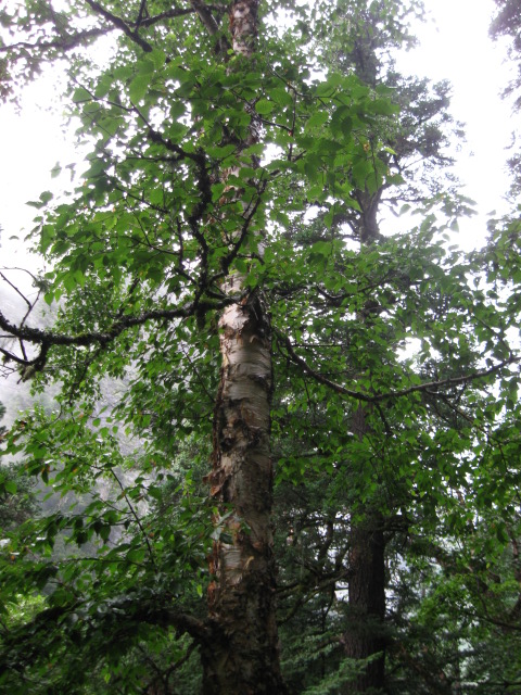
The first 2-3 kilometers of the trek is crowded, a little messy with horse dung and not as scenic as the rest of the trek. This is the portion of the trek where one cannot really see the river. After the first few kilometers, Ganges is always by your side, and she is a delight to watch. The routes are fairly well maintained and the credit entirely goes to the Garwal Tourism department. While I am an impatient hiker, and like to keep a medium steady pace and not stop unless I was tired or there was a great reason to do so, my friend preferred to soak in the beauty. I am glad she did so, for she would then point out some of the birds, insects and flowers that I had almost missed on my way up. I especially remember a particular wood pecker that seemed oblivious to the buzz of activity below it and was intent only on craving its niche in the tree.
By the time we had hiked about 7 km, the river was accessible by foot, and looked very inviting. We spent a good 45 minutes playing in the water, washing our hands and feet, and refilling our water bottles from the same flowing water. Bottled water along this route costs Rs.40 per bottle but they were also labeled as "pure mountain water". The water from Ganges was ice cold and tasted exquisitely refreshing. There were snow capped peaks in the distance,and an occasional view of the Narparvat through the clouds. We made a couple of more stops along the way by the river to refresh ourselves. To me, these stops were the most memorable parts of the trek, and I would think the journey completely pointless if one was to bypass this experience. There are plenty of food stalls throughout the route where they serve hot parathas, maggi, chowmein, etc. You can also grab a hot cup of chai or juices at some of these stalls. A restaurant near the 10 km mark has seats by the river. We noted it on our way up, and stopped here for breakfast on our way down.

The last stretch of 2-3 kms was easily the toughest leg of this day's trek. We shared little conversation and were intent on conserving our energy for the monstrous and slippery climb. One reason why the trek was harder than it should have been is the terrain. There is no crushed gravel acting as a cushion, it's all hard and uneven rocks and stones that eventually start to tell on your foot muscles. We were lucky that it was not raining that day, or the whole journey could have been more miserable and dangerous.
However, we did eventually reach the outskirts of Ghangaria, and spent a relaxed hour near the helipad enjoying the views of the surrounding mountains and the flat valley and amused to see Sun rays trying to find gaps within the mountains, and find their way into the valley. We were still half a kilometer away from the village of Ghangaria. We slowly made our way up the last stretch, and began looking at rooms to stay. There was a Gurudwara at Ghangaria as well where a lot of Sikh pilgrims stayed. We however gave up trying to walk through the village and stayed at a hotel which we thought was clean and respectable. We paid Rs.400 for the room with a double bed for each night. There is power in Ghangaria only for a few hours each morning. It being the monsoon season, everything was damp (including the beds, and the walls), so I suggest keeping a dry bed sheet in your bag( I would not have been able to sleep without that), and plenty of spare clothes. If you trek in rain, your clothes will mostly likely never dry until you get back to Govindghat or Haridwar. The hotels supply hot water for Rs.10/ bucket. There are no telephone lines that run up to Ghangaria (people only stay here during the summer and migrate down the hill for the rest of the year), and no likelihood of obtaining cell phone signals. There are however satellite phones that charge Rs.20/ minute. We used those to let our families know that we were alive and well.

After rest and refreshments, we watched a very informative and interesting documentary on the Valley of Flowers. We then tried to locate a Mr. Rajneesh Chauhan, a renowned guide in the area. When we expressed our interest in hiring him for the next day, we learnt that he was already hired by two South African botanists. However, the ladies found us agreeable and were willing to let us tag along. We paid him Rs.1200 for the day, and he was worth every paise we paid him. We agreed to meet him at his store at 7 AM the next day, stopped at a nearby hotel to order parathas to-go for the next day's lunch, and finally retired for the day.
Day 4: Ghangaria - Valley of Flowers - Ghangaria : We woke up the next day to pouring rain and dark skies. There seemed no hope for sunlight that day, and in a slightly dismal mood set out to meet the rest of our group. We were also joined by an Irishman who had spent a month in India vacationing, and seemed to be having the time of his life. We trekked all day wearing our ponchos and unwilling to bring out our cameras. We had the most wonderful guide however, and it was very difficult to sulk at the weather. He pointed out all the rare plants and flowers( and the botanical names for the botanists), their medicinal properties, and their unique characteristics. He found us wild strawberries, blue berries and the strongest smelling Tulsi ever. I stole a few leaves of Tulsi back home to Hyderabad, and we enjoyed some of the best tea of our lives. He also put leaves of some plant (whose name I cannot remember) in our water bottles, and told us that they were a natural energy drink. And by God, was he right! On retrospection, the rain did not ruin our sighting of the flowers, but it did spoil the overall scenery. The clouds were so low that we could see the surrounding mountains only occasionally. Neither of us were wearing water-proof shoes and were soon hiking in squishy wet shoes. In-spite of this, the valley was beautiful. At the very heart of the valley, it is hard to imagine that we were up at an elevation of over 14000 ft, and yet, we were surrounded by so much greenery, so much color, and 40,000 ft tall mountains. Our guide also told us how and when some of these flowers would change colors, and how some of these flowers have become rarer over the years. The valley is known to appear a different color every week, and from his own vast collection of photos, I could believe that.

 |
| Bhojpatra -Bark of which was used in ancient manuscripts |
 |
| Blue Poppy |
 |
| At the valley |
 |
| Other Side of the valley |


At 1 PM, it had not stopped raining, and our guide suggested that we turn back before the rain starts triggering landslides. We were very disappointed, for we would have liked to have gone on further, but we agreed with the wisdom of his decision. We did however convince him to go another half a km into the valley to the river Pushpawati. This water was melting right from the glaciers above, and I lost the feeling in my fingers for a good half an hour after touching this water, but I can never forget her taste. It was cold and slightly sweet at the same time. I brought back a bottle of this water back home for all my family. The valley is known to house some of the most medicinal herbs in the world, and Pushpawati was bringing down some of those herbs in her water to us. The foreigners were slightly apprehensive as my friend and I were greedily drinking this water, until we convinced them to give it a try as well. They did not regret it. Locals believe that this water by itself is known to cure some diseases.
After this point we turned back, and started our journey back to Ghangaria. It was 4 PM by the time we reached the village, and the skies had finally cleared. The others in our party had planned on staying a couple of more days. Some others also planned to trek to Hemkund Sahib from Ghangaria ( 6 kms each way, and a lot steeper). Unfortunately, we had to head back down the next day. The trek to the valley from Ghangaria is 3.5 kms, and we walked another 2 kms into the valley before heading out. One can walk as many as 6 kms into the valley before turning back. On our return Rajnesshji treated us to some great herbal tea in his store made from different herbs he had stocked up over different times of the year.
Day 5 : Ghangaria to Govindghat - Badrinath : We started our downward trek to Govindghat the next morning at 7 AM. The same porter we had hired on our way up had made another trip the previous day, and was willing to take our bags down for another sum of Rs. 600. The previous day's rains had made the path much more slippery, and I was glad for the hiking stick that I had borrowed from Rajneeshji the previous evening. We once again stopped at our favorite spots along the river, and did not really hurry ourselves down. My friend had made an interesting observation that there were no women to be found at Ghangaria or in any of the stalls anywhere along the 14 km hike(apart from tourists). On our return hike however, we saw a lonely woman sitting all by herself and selling rhododendron juice. She told us that the men move up to Ghangaria during the pilgrimage season while the women stay in Bhundyar village (a few kms uphill from Govindghat), and thats where she had lived all her life. We asked her about climate and life at Bhundyar, and she gave us a smile and said we could also look it up on the internet! That was a welcome change from some of the men who thought we were foreigners just because we were wearing jeans!Once at Govindghat, we had a nice lunch at the Gurudwara, made a few rotis as seva and made our way towards the bus stop. It was close to 2 PM by then, and there would be no buses heading downhill at this time. To head back to Haridwar, we would need to catch a bus early next morning. Badrinath being only two hours further uphill, we decided to flag down a bus that was heading that way.
After more than an hour's wait, we finally managed to get seats for Rs.35 each on a bus that was heading to Badrinath. The route from Chamoli to Joshimath paled in comparison to the route from Govindghat to Badrinath. I spent most of my two hours trying not to look outside the window and praying to God to keep me alive beyond that day. A middle aged lady traveling with her family struck a conversation with us, and gave us some wrong information that almost ruined our schedule. She claimed to have been to Badrinath before, and told us that the temple closes at 5 PM, and that the priests demand a lot of money to open up darshan to each person. She further misled us into believing that we would be unable to leave before 7 AM the following morning, and to book our return bus tickets only after darshan. I strongly advise people to book their return bus tickets as soon as they reach Badrinath. We did not do that, and spent a lot of time talking to locals, and confirming that the temple would be open until well past 8 PM. We then found ourselves a very comfortable room in an ashram right across the bus stop for Rs.300. We had by then decided to book our tickets on the first bus out before heading to the temple. Each ticket to Haridwar cost Rs.350, but because we had delayed, we ended up with the last seats in the bus at its very back. Of course, this proved to be extremely uncomfortable.
We grabbed some spare clothes and headed to the the temple. The temple is situated on the banks of a gushing Alakananda, encompassed between snow capped peaks of Nar and Narayan parvat. A trip to Badrinath can never be complete without a dip in the hot springs. As per legend, Adi Shankaracharya charmed the water in the springs to always remain hot for his guru who was staying in Badrinath for a few months performing penance. In any case, it is a miracle that in such extremely cold surroundings, the water from the springs was steaming hot. It was too hot to touch for more than a coupe of seconds at a time. Rooms have been built around the springs to provide privacy for women. It was one of the most enjoyable baths I had ever had. This was followed by a very wonderful and relaxed darshan of the lord (no bribe paid to anyone), a quiet dinner and a very tired walk back to the ashram. By then, the clouds had descended right up to our eye level.
 |
| Badrinath |
Day 6: Badrinath to Haridwar: The bus from Badrinath left on time at 4:30. It was fairly uneventful, and we were too tired to even speak much to each other. We did however grumble a lot about having to eat parathas one more day, and were looking forward to Dosa Palace at Haridwar. We reached Haridwar at 6 PM and found lodgings at a nearby hotel (GMVN was booked). We could have caught a bus to Delhi the same night, but even our train tickets for the next afternoon had not left us much flexibility in our schedule.
Day 7: Haridwar to Delhi : I woke up at 6 AM the next morning, and caught a rikshaw to Har ki Pauri. The city was already busy and noisy. I did not want to leave Haridwar without a dip in the Ganges, but I was actually very surprised at how good it felt! Afterwards, we made our way to Manasa Devi temple, but the cable car was closed for the day, and we had no strength to walk up to the temple. Instead, we rode the cable car to Chandi Devi temple, and were once again stuck in heavy rains while shopping on our way back. With difficulty, and relief, we found ourselves sitting on the train back to Delhi, not able to believe that luck stayed with us until the very end!


